Salton Sea communities thrive when we address poor health outcomes. We are conducting community science to produce publicly available data and inform solutions to the challenges of the receding Salton Sea and improve health outcomes for residents.
Community Science
Salton Sea Environmental Timeseries
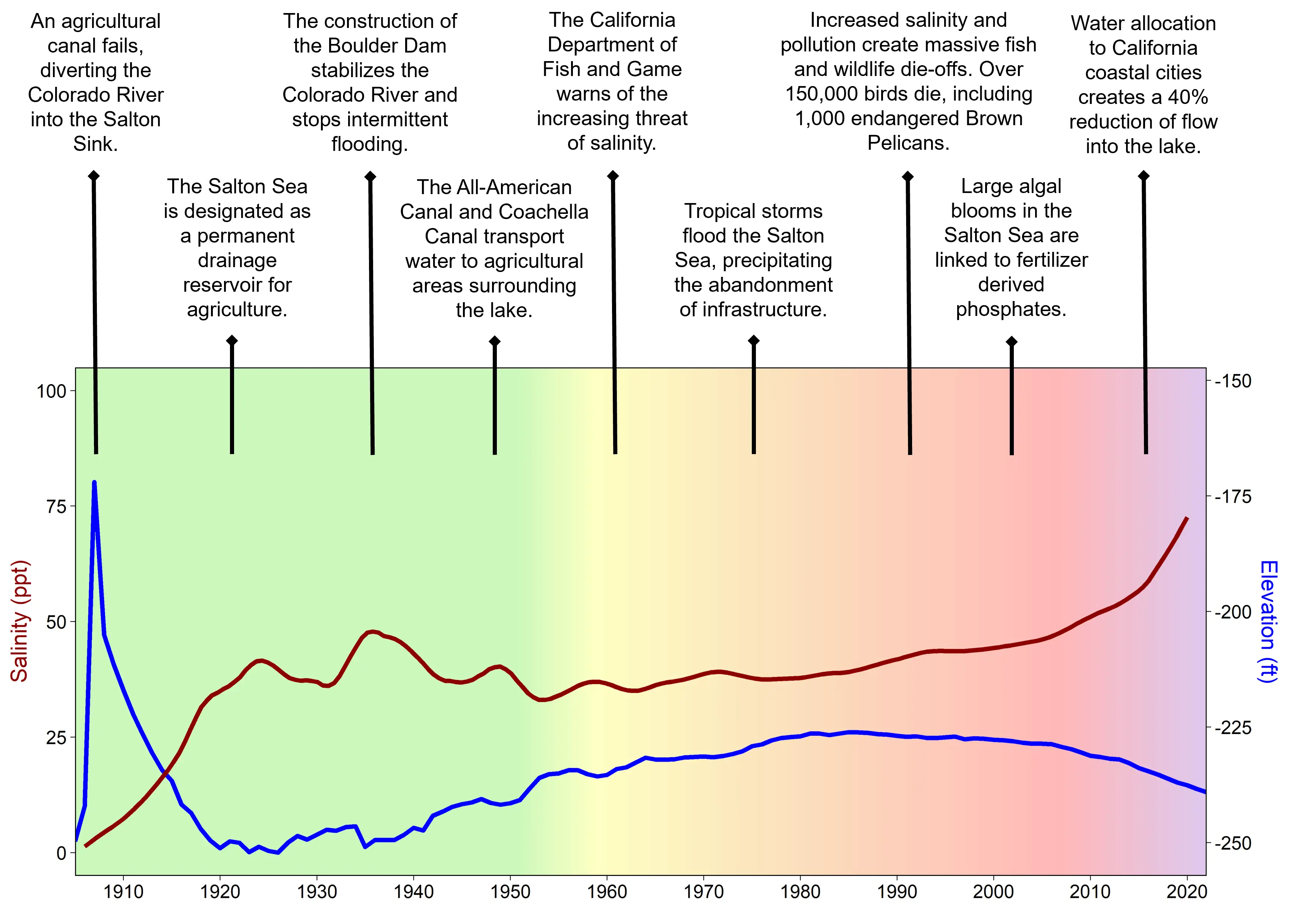
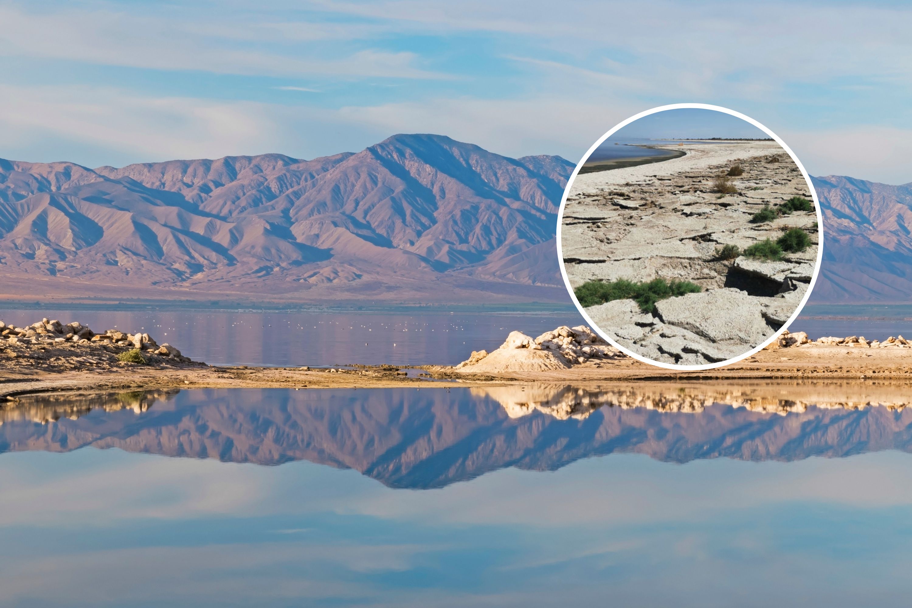
The Salton Sea is a hypersaline inland lake that plays an important role in the surrounding communities and ecology. Located in Riverside and Imperial counties, it constitutes part of unceded Torres Martinez Desert Cahuilla Indian territory and is an important stopover for migratory birds along the Pacific Flyway. The origin of the current Salton Sea traces back to 1905, when Colorado River water breached an irrigation canal and spilled into the Salton Sink. Since then, the Salton Sea has been fed by agricultural runoff and outflows from local rivers such as the New River, Alamo River and Whitewater River. Unfortunately, decades of detrimental policies have turned this region into an environmental disaster.
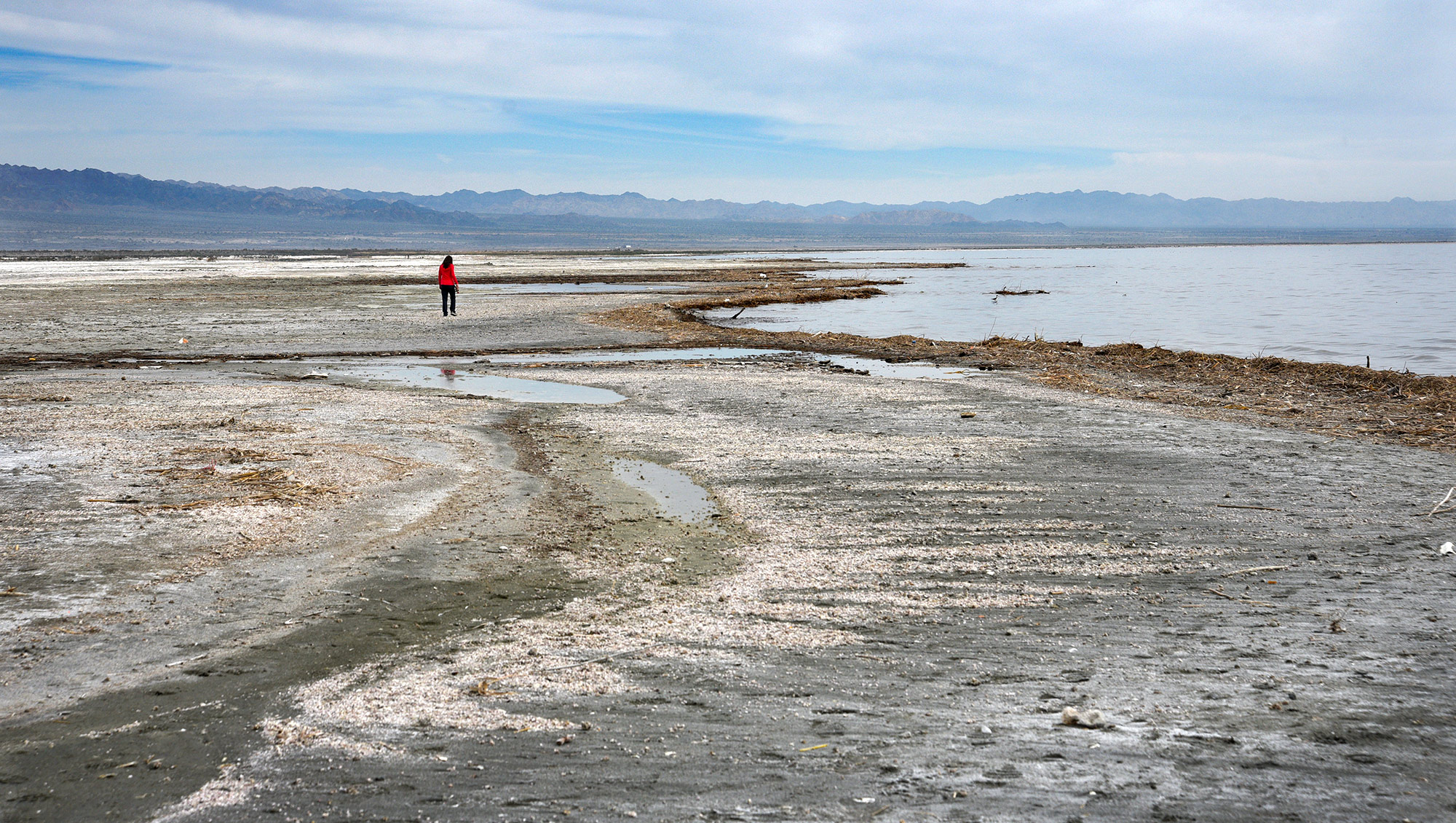
Normally fed by offshoots of the Colorado river, redistribution of water allocation from the Colorado river has led to a significant reduction in water inflow to the lake over the recent years. In 2003, the Quantification Settlement Agreement between the Imperial Irrigation District, the San Diego Water Quality Control Board, and other government entities, agreed to divert water from the Imperial Valley to San Diego County, reducing the inflow available to the Salton Sea and causing the Sea’s water volume to begin shrinking. From 2003 to 2017, mitigation water (105,000 acre-feet) was allocated to the Salton Sea, abating the dropping sea level. However, the Salton Sea surface area has been rapidly declining since mitigation water ceased to be allocated to the region in 2017, altering the water properties of the Sea, exposing miles of dry playa, and contributing to a public health crisis. In fact, over the past few years, the Salton Sea sea level has been declining at a rate of about 0.3 meters a year (1 foot per year). The Salton Sea has been classified as an impaired body of water by the US EPA and the California State Water Resources Control Board.
The accumulation of runoff water in the Salton Sea, combined with rapid evaporation and detrimental policies, have led to an increased salinity, hypoxia, the proliferation of harmful bacteria, the exudation of foul smells, and the accumulation of toxins in the soil. Wind blowing over the Salton Sea releases toxic dust from the previously covered lakebed (often referred to as playa) and aerolizes chemicals from the surface of the water, leading to chronic respiratory illnesses in surrounding communities.
The Salton Sea Environmental Time Series is a community science initiative led by a team of community members and non-local scientists conducting water and air quality monitoring research on the Salton Sea. This research will be used for community capacity building and advocacy efforts, and is facilitated and convened by local non-profit organization, Alianza Coachella Valley.
This initiative will provide nontechnical and accessible data for community engagement through an online dashboard. The goal is to use community science to better understand the impacts of the receding Salton Sea and incorporate that knowledge into actionable solutions, which includes creating a cleaner Salton Sea for the benefit of the environment and the surrounding communities. Through this work, our vision of a more beautiful, healthy, thriving, and united Salton Sea Region can become a reality.
Our team is currently conducting research on the northern region of the Salton Sea (see map on the Dashboard tab) in hopes that this will lead to the implementation of more infrastructure projects that can address environmental sustainability, public and environmental health, and economic development so that this region can prosper.


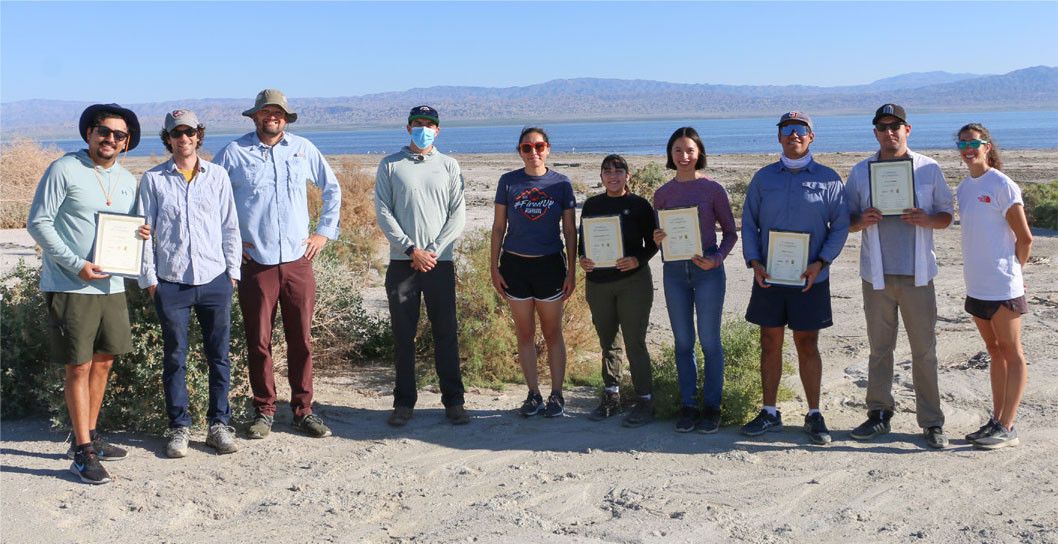

The annual California State Waterboard Resources Control Board workshop was held on May 16th and May 17th of 2023 at the Imperial Valley College. Our very own community scientists (Cruz Marquez and Daniel Ramirez) and Dr. Ryan Sinclair were asked to be part of two panel discussions that talked about water quality and community voices and projects. These two topics were important to present to the public, the state waterboard, and the broader public as it leads to more visibility about the challenges the Salton Sea is facing and can lead to a common understanding about the possible solutions the state can act upon. We encourage you to watch both panels that were part of a larger range of topics. Dr. Ryan Sinclair’s portion is from about 1:55:45-2:29:00
The annual California State Waterboard Resources Control Board workshop was held on May 16th and May 17th of 2023 at the Imperial Valley College. Our very own community scientists (Cruz Marquez and Daniel Ramirez) and Dr. Ryan Sinclair were asked to be part of two panel discussions that talked about water quality and community voices and projects. These two topics were important to present to the public, the state waterboard, and the broader public as it leads to more visibility about the challenges the Salton Sea is facing and can lead to a common understanding about the possible solutions the state can act upon. We encourage you to watch both panels that were part of a larger range of topics. Community voices and projects panel is from about 2:29:30-3:11:45.
The Alianza community science team presented a live webinar on the 7/20/22 to present the findings of water quality research conducted at the Salton Sea between 2021 and 2022. We hope you find it informative and illuminating as we continue to conduct community science-based research in the future.
†Many of these articles use highly negative language such as “toxic” and “death pit” in referring to the Salton Sea, portraying a hopeless situation. While we are very aware of the environmental state of the Salton Sea, we believe such language is damaging to the surrounding community and discourages remediation efforts. We encourage the use of positive language that centers not just biodiversity but the community and their stories who deserve a restored sea.


Jackie Castillo

Destiny Silva

Jacqueline Lucero
